AI for Early Detection of Wildfires
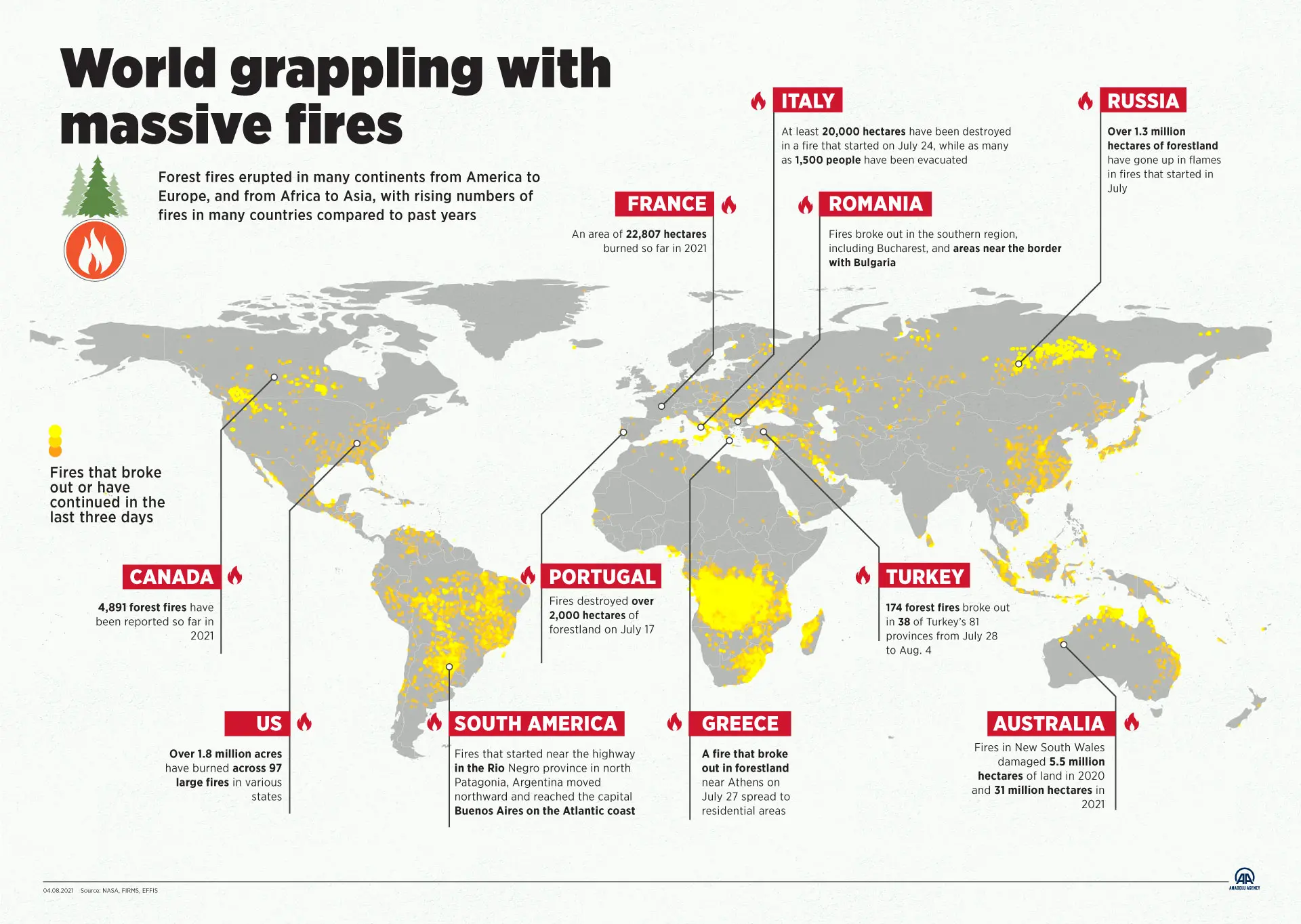
The intensity and frequency of wildfires have remarkably increased in the last years across the world. The Australian wildfires of 2019 and 2020 were one of the deadliest forest fires. It killed half a billion animals, burnt 20 million acres, and cost $100 billion in damages. Unfortunately, the existing fire detection systems have a lot of shortcomings. Luckily, data science and tech companies such as RADFIRE and Sintecsys are stepping in to develop a new generation of tools. They are combining high-quality satellite imaging, deep learning, and artificial intelligence to detect wildfires.
How Does it Work?

One thing that makes wildfires particularly dangerous is that they are highly unpredictable. They are often detected too late while the fire has already widely spread out. Seeing wildfires as early as possible and rapidly responding is essential to preventing a potentially deadly disaster. This is where artificial intelligence, machine learning, and big data come into play.
Definition:
- Artificial intelligence: It is the science of making machines intelligent by using algorithms to allow computers to solve problems previously only solved by humans. Its goal is to mimic the human brain and create systems that can function intelligently and independently. Artificial intelligence technologies today are brilliant at analyzing vast amounts of data to learn to complete a particular task. This technique is called machine learning.
- Machine Learning. It combines statistics and computer science to equip computers with the necessary data to learn to do a specific task without being programmed in advance. It seeks statistical patterns within the data and establishes an algorithm by which the computer will sort future data. The more data the scientists expose to the computer, the more finely tuned its algorithm will be and the more accurate it can be in its predictions.
Typically, fire authorities most often rely on human spotters and aircraft to report ablaze. Therefore, the incident commander orders a plane to fly over the site to collect images at night. However, this exercise is limited by the availability of aircraft and raises safety concerns. In addition, the aircraft cannot always penetrate the smoke cover to collect images that pose a danger to the pilot. If successful, the images are passed to an analyst to draw the maps manually in the morning.
Artificial intelligence platforms scan thermal imagery from satellites beyond what the human eye can see to find temperature anomalies or hot spots just minutes after they spark. High tech companies use cloud-based artificial intelligence and machine learning models to analyze real-time open-access high-resolution earth observation satellite imagery to identify fires.
The information paired with damage assessment tools will help commanders to make instant decisions at critical times. The data will help them deploy their resources effectively, predict the fire’s spread, manage it, find safe routes for the firefighters, know where to drop the fire retardants, ensure the safety of the citizens, and prevent the worst from happening.
Other than detecting wildfires, computer programs that use artificial intelligence can predict the development of fire. For example, it can identify locations with conditions suitable for the next wildlife outbreak based on meteorological data associated with past wildfires, such as wind conditions and topography. Then, the program looks for meaningful patterns in the data, performs analysis, and makes future predictions displayed on a map.
Final Thoughts
As climate change and global warming pose significant threats to the planet, all the countries can adopt this innovative technology worldwide to predict, detect, and contain wildfires erupting in their territories. This will help avoid home destruction, loss of wildlife habitat, release carbon dioxide into the atmosphere and pollute the air with emissions harmful to human health.
Extreme environmental events fueled by climate change such as floods, hurricanes, droughts, and storms cost US taxpayers $99 billion in 2021. On the bright side, data scientists can incorporate cloud-based artificial intelligence, machine learning, and satellite imagery to detect other disasters besides wildfires caused by the climate crisis. Thus, artificial intelligence has the power to change the world positively and ensure a better world.


